Here's one hack for the road. I used this for my recent Amsterdam day trip while in transit and it worked like a gem. The free map wasn't detailed enough and I didn't want to pay 0.50 euro for a tourist map (which might be just as undetailed) from a vending machine.
What you would need for this hack: A smartphone, the Google Maps app, a little homework beforehand
Pros:
+ Does not require Wifi/data (i.e. works offline!) when you save a particular area as an Offline Map
+ You can navigate your route on foot yourself with the help of the built-in compass (or GPS? I'm not sure how it works, but it just does)
Cons:
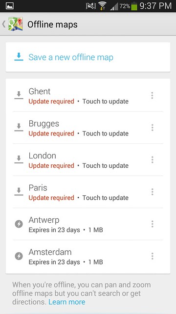
- A limit of 6 Offline Maps
- When used offline, you are unable to get any route information (i.e NO walking, driving or public transportation directions)
- Unable to add details for places that you save. If you save a street name, you might not remember if it's a bakery, a sight, a lodging, a bank.. (you get the drift!)
- Will suck the life out of your phone
Overall: Still useful nonetheless, provided you can read maps (I can!)
Here are the steps (please note that Google constantly updates their stuff, this worked at time of posting)
1. Using your smartphone with Wifi/data access, open the App and search for the places you are interested in.
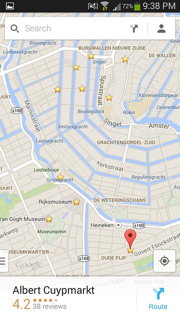
2. When you save them, the places will be marked with a star.
3. Then download the offline map of the area. Click on the human-looking icon next to the search bar. You can decide on the size of the area you want to save.
4. Even without Wifi/data, turn on GPS when you
want
need to use the map. You will not be able to get the directions, but clicking on the 'location' icon on the bottom right will give you your current location, and the direction that you should walk towards, toggle it again to get another view.
And you've hacked it!
*Note that you might need to Wifi/data to update the map after a certain number of days.
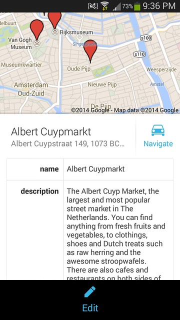
You can also try out Google Maps Engine (which allows you to save details of places, draw boundaries, change the pins, but does not work offline) or Pin Drop (a promising app which I hope to test soon!).
How Maps Engine looks:
Clearly the most ideal app will be free, allows you to personalize your map (like in Maps Engine), AND download it for offline use (like in Google Maps), AND not require regular updates. Till then, let's make the best with what we have!


[…] I like it, suitable for a day-trip, yet charming enough should you wish to stay longer. Using the Google Maps offline features, I had earlier saved some attractions in Antwerp for my Walking Tour, Antwerp […]
ReplyDelete